1. General Overview
Jul 18, 2020
1 min read
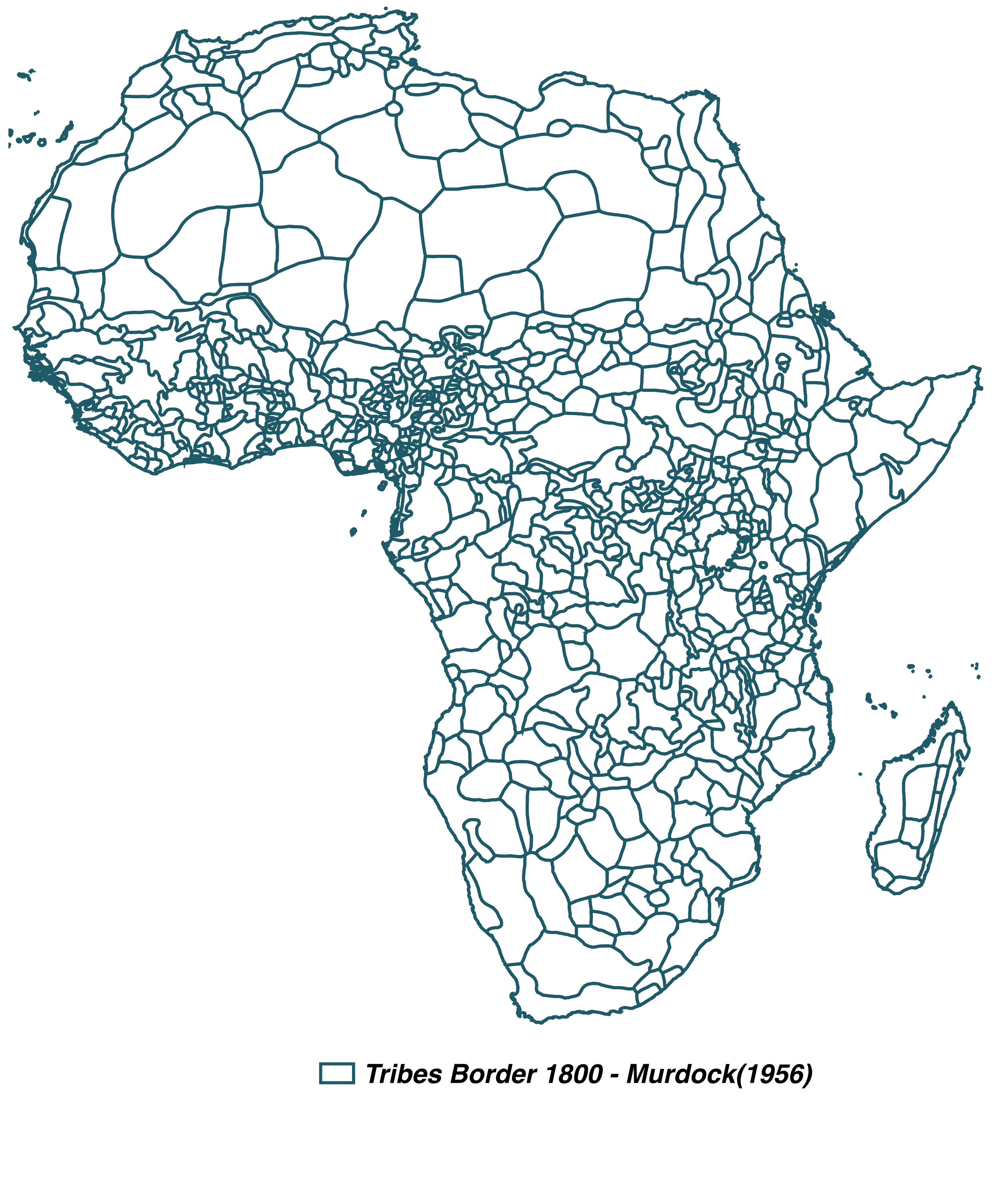
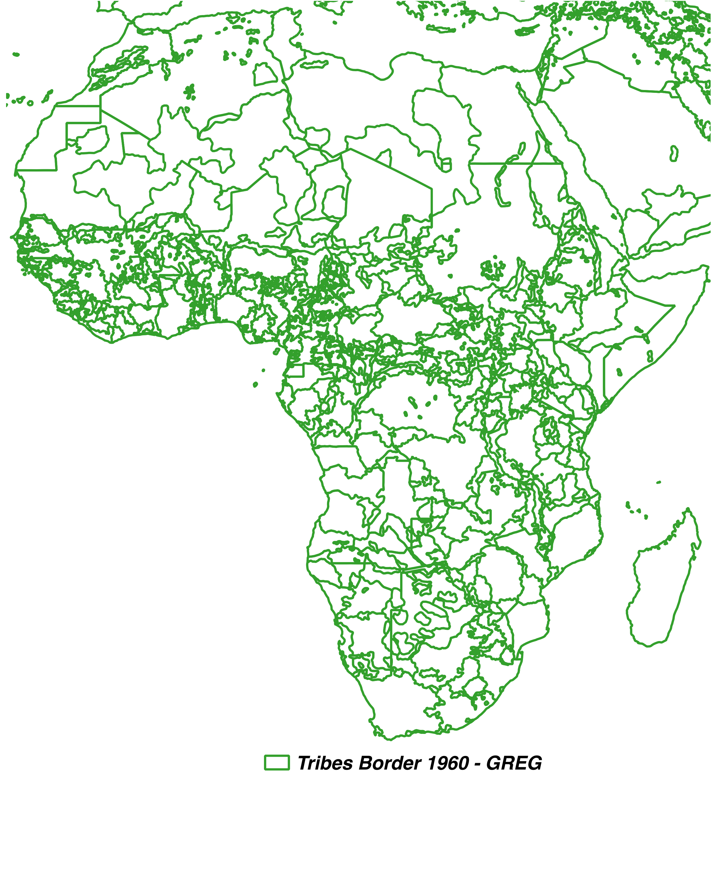
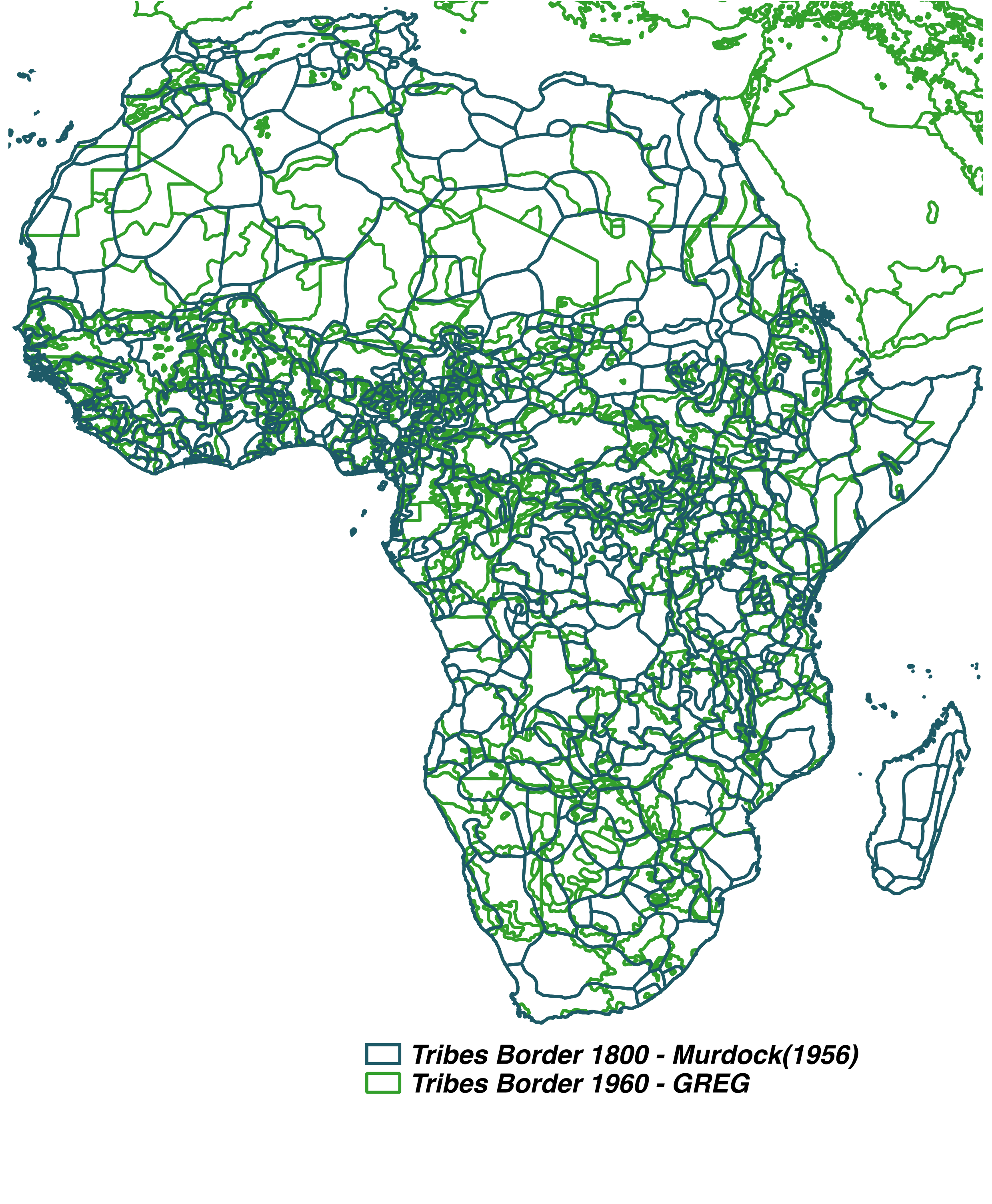
The goal is to establish which African tribal groups have moved/changed since 1800. Pre-colonial tribe names are determined by the Murdock Map of Ethnic Boundaries (1956), which refers to the location of the groups in 1800. Current tribe names come from the GREG data set (2010), which refers to the location of the groups in 1960. The first step is to produce a dataset of the intersection of the two maps of ethnic boundaries. The two shapefiles are overlapped, an identifier for the intersected areas is generated (i.e. Intersection ID).
 |
|---|
| Ethnic Borders - Murdock (1956) |
 |
|---|
| Ethnic Borders - GREG (2010) |
 |
|---|
| Intersection Ethnic Borders - Murdock (1956) and GREG (2010) |
Whereas Murdock (1956) has 834 tribes, GREG (2010) has 218 unique ethnic tribes in Africa. After intersecting both data sets, we find 4192 intersections. These intersections have an area is 10,547.16 km2, on average. Then, we determine whether the tribe names in GREG and Murdock, of each geographical intersections are the same/equivalent or different. The details on the matching procedure are described in the following section.
Basic Information of the intersection between Murdock and GREG
| Number of Tribes in GREG (2010) | 254 |
| Number of Tribes in Murdock (2010) | 830 |
| Number of intersections Murdock-GREG | 2143 |
| Total Geographical Area | 30,658,382 km2 |
| Average Area of each Intersection | 14,319.36 km2 |
| Max Area of each Intersection | 378,179.2 km2 |
| Min Area of each Intersection | 566.15 km2 |
Sharing is caring!